
Knockanora [Cnoc an Fhothraigh]
Good walks are even better shared.
Overview
Knockanora [Cnoc an Fhothraigh]
Overview
Knockanora, affectionately known in Irish as Cnoc an Fhothraigh, is a gem of a Marilyn tucked away in County Kerry. Standing at an elevation of 383 meters, it may not be the highest peak in the region, but it certainly packs a punch with breathtaking views and a charming trail suited for outdoor enthusiasts of all skill levels.
Geology
This hill is draped in granite, with fascinating weathering patterns that spark curiosity amongst geology buffs. The mix of sandstone and schist adds to the beautiful tapestry of natural texture and colour. For those inclined towards geology, Knockanora offers a mini geology lesson amid the lush Irish landscape.
Routes
The Knockanora Loop Trail is the main path that winds its way up to the summit. It offers a delightful combination of challenging sections and manageable stretches, making it accessible for most hikers. Clocking in at approximately 4.5 km in length and typically taking around 1.5 hours, it’s perfect for a day out with family or friends.
Summit Features
At the peak, there's a quaint stone cairn—you could even say it’s a traditional Irish 'welcome committee' waiting for you at the top. On a clear day, this spot is perfect for a well-deserved picnic whilst drinking in the sweeping views of the surrounding hills and valleys.
Terrain
The trail itself is predominantly grassy, interspersed with rocky patches that might have you feeling like a seasoned mountaineer. Do keep an eye out for the occasional boggy area—shoes can easily get muddied, adding an unexpected twist to your adventure!
Views
The vistas from the summit are outstanding. To the north, you can see the Slieve Mish Mountains playing peekaboo through the clouds, while the shimmering waters of Tralee Bay add a bit of flair to the southern view. Spring and early summer are particularly enchanting times for hiking, thanks to the vibrant flora adorning the hills.
Hazards
Caution is advised on slippery sections during wet weather, and you may even encounter some wildlife. Keep your eyes peeled, as the hills often serve as home to various critters, including birds and the occasionally inquisitive sheep!
Access
Parking is conveniently available at the base of the trail, with much room for cars, though larger vehicles may need to be a little more creative. If you’re relying on public transport, be aware that the nearest bus stop is 9 km away in the lovely village of Glenbeigh.
Facilities
While the immediate area lacks extensive facilities, Glenbeigh is just a short drive away and has several quaint cafes and a lovely local shop for treats and supplies. Public toilets are also available, ensuring you are well-prepared for your hike.
History
The name ‘Cnoc an Fhothraigh’ reflects the beautiful valleys that cradle this hill. There's a lovely sprinkling of folklore attached to Knockanora, making it not just a hike, but a journey through tales of ancient warriors and mythical beings.
In conclusion, whether you’re a casual hiker or a seasoned ramble enthusiast, Knockanora offers a delightful experience in beautiful County Kerry. As always, pack your sense of adventure and maybe a snack or two—just in case the views leave you a bit peckish!
Explore routes near Knockanora [Cnoc an Fhothraigh]
Public walks starting within 80 km of this hill. Nearby does not mean a route reaches the summit; check its map and access before setting out.
No public routes are currently listed within 80 km of Knockanora [Cnoc an Fhothraigh] on Walkmates. This does not mean there are no paths here. Explore the map and check local access information before planning a walk.
Route planning notes
These notes describe possible approaches, not verified navigable routes or permission to cross land. Check current paths, local access rules and conditions before setting out.
Knockanora Loop Trail
A scenic loop trail that starts at the base of Knockanora, meandering through lush greenery and occasional rocky outcrops. A perfect mix of challenging ascents and gentle stretches.
Make a day of it, together
Find someone to share the walk with, or organise a day out along a route you like.
Hill facts and local notes
Classifications
Elevation
433m
1,421 ft
Prominence
248m
Coordinates
52.7913, -7.9859
S010711
OS Map
59
At the Summit
At the summit, you'll find a small stone cairn that offers a perfect resting spot to admire the views. The area also features heathland patches adorned with vibrant wildflowers, depending on the season.
Terrain & Geology
Granite outcrops dominate the area, with patches of sandstone and schist adding to the geological tapestry. The weathered rock formations create a fascinating landscape and provide glimpses into the earth's history.
Views & Scenery
Marvel at the stunning vistas of the surrounding hills and valleys, particularly the expansive sight of the Slieve Mish Mountains and the tranquil vista of Tralee Bay.
History & Heritage
Name Origin
Cnoc an Fhothraigh translates to 'hill of the valley', reflecting the geographical features surrounding the mountain.
Historical Significance
Knockanora is significant not just for its stunning views, but it also holds a place in local folklore, often associated with ancient tales of warriors and mythical creatures.
Getting There & Facilities
Check current local access restrictions, parking rules and transport timetables before travelling. These notes do not confirm public access to the summit.
Parking
Parking is available at the base of the Knockanora Loop Trail. Look for the small, gravel parking area just off the main road leading into the hills.
Public Transport
The nearest bus stop is in the village of Glenbeigh, approximately 9 km away, with limited service available.
Nearby Facilities
While facilities directly at the trailhead are limited, Glenbeigh offers several cafes, shops, and public toilets for post-hike refreshment.
Safety Information
Known Hazards
- Beware of slippery tracks during wet weather, and watch for wildlife on the trails.
General Safety Tips
- Check weather conditions before setting out
- Carry appropriate clothing and equipment
- Let someone know your planned route
- Take a map, compass, and GPS device
- Carry emergency supplies: food, water, first aid kit, torch
Hills
Some common questions about the hills answered
Are there group walks up Knockanora [Cnoc an Fhothraigh]?
Many walkers use Walkmates to join or organise walks with others. You can check for group walks around Knockanora [Cnoc an Fhothraigh] through the maps
Are there other walkers around Knockanora [Cnoc an Fhothraigh]?
Activity varies by location and time, but Walkmates lets you see whether others have shared walks or shown interest in this area. Find other people through the walking friends search walking friends for Knockanora [Cnoc an Fhothraigh] search or of course create your own walk for Knockanora [Cnoc an Fhothraigh]
Can I organise a walk to Knockanora [Cnoc an Fhothraigh]?
Yes. If there aren’t any walks listed already, you can create a walk and make it available for others to join.
If you're signed up to Walkmates, you can create a walk to Knockanora [Cnoc an Fhothraigh].
How do I find a walk up this hill?
There are often multiple ways to walk this hill, depending on experience and route preference. Walkmates helps you explore walks and routes that others have shared.
Can I suggest a new route up Knockanora [Cnoc an Fhothraigh]?
Yes. You can suggest or create routes to share with others. Walkmates focuses on the social side of walking, so routes are used to help people organise walks and explore areas together, rather than as detailed navigation tools or route libraries.
Other uses really appreciate knowledgeable walkers sharing their routes. Share your favourite route to Knockanora [Cnoc an Fhothraigh] here
The is an error or something incorrect about this hill. How do I let you know?
We always strive to keep the information on Walkmates as accurate as possible. If you find an error, please let us know through the contact form and we'll aim to correct it as quickly as possible
Community Discussion
Comments
Location
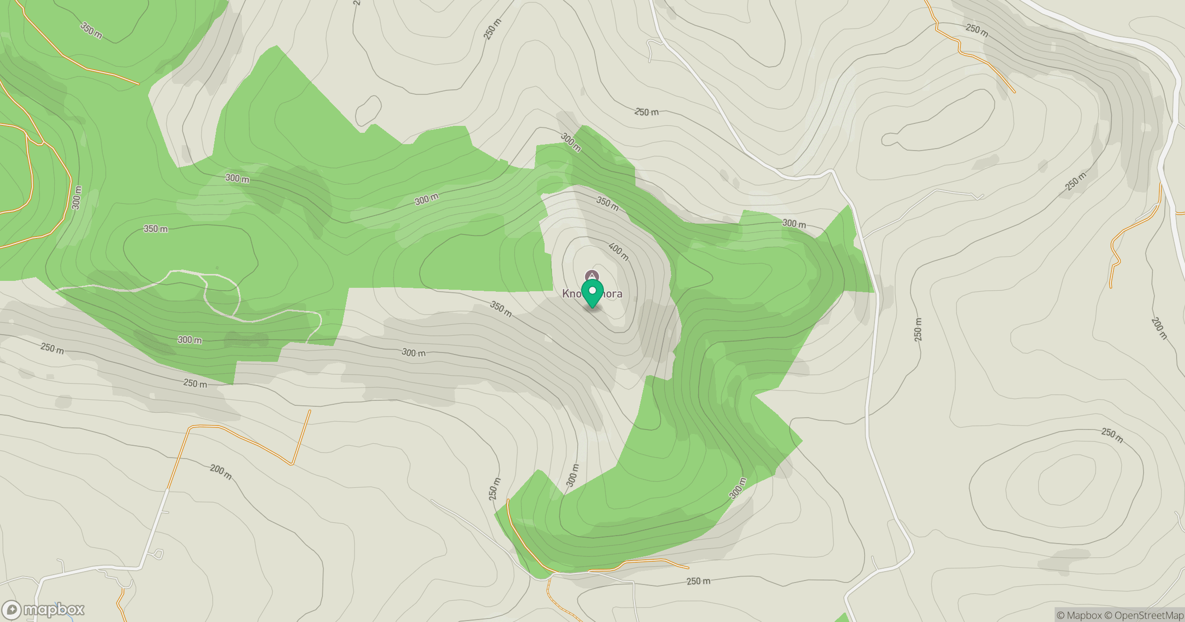
Grid reference: S010711
View on OpenStreetMapOpens a map in a new tab, centred on the hill.
Hills within 30 km
Straight-line distance, not a walking route or confirmation of access.
Devilsbit Mountain [Bearnan Eile]
480m
Gortagarry [Ballinveny Hill]
458m
Coumsallahaun
320m
Knockadigeen Hill [Cnoc Duiginn]
402m
Cooneen Hill [Cnoc an Chuainin]
467m
No comments yet. Be the first.